because i find navaids of the continental south-east rather interesting, and this an exemplary piece of journalism and graphic design ..
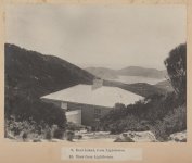
THE LIGHTING OF BASS'S STRAITS The Herald Fri 19 Sep 1913
https://trove.nla.gov.au/newspaper/page/26287496
 if this kind of thing does interest anyone else i propose to share scraps on various victorian public works projects, and would hope to see other contributors ...
...
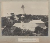
THE LIGHTING OF BASS'S STRAITS The Herald Fri 19 Sep 1913
https://trove.nla.gov.au/newspaper/page/26287496
...
Last edited: